360° Panoramic Photography
Commercial Drone Services
360° Immersive Virtual Tours
Photography Workshops
Online Sales and Downloads
Blogs and Journeys
Sea to Summit with Scotland360°
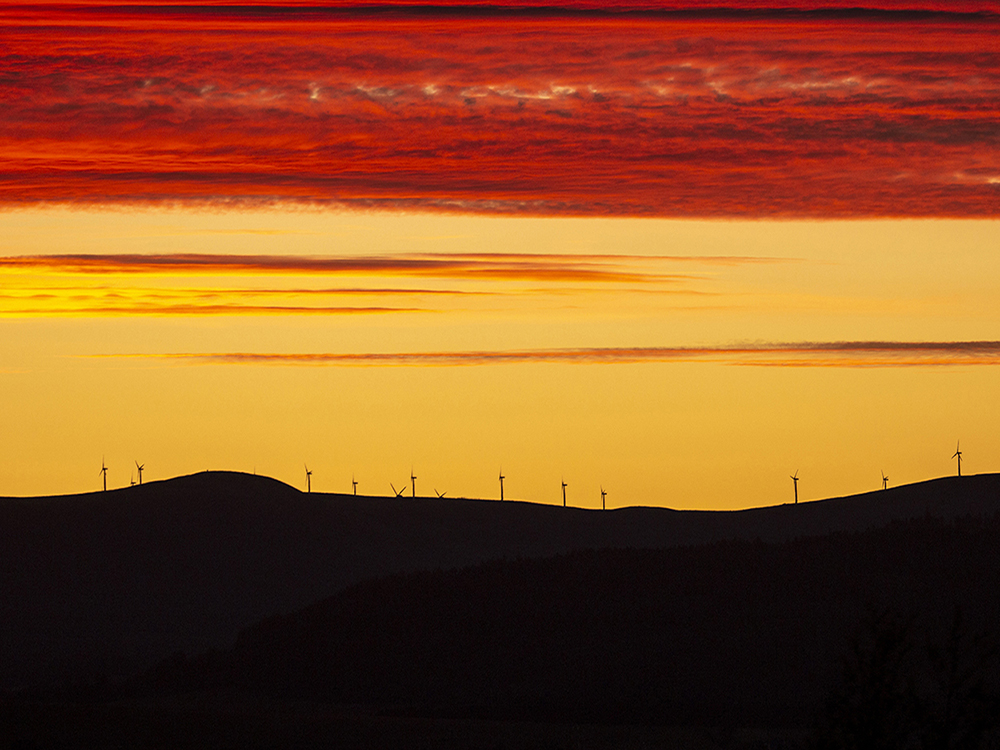
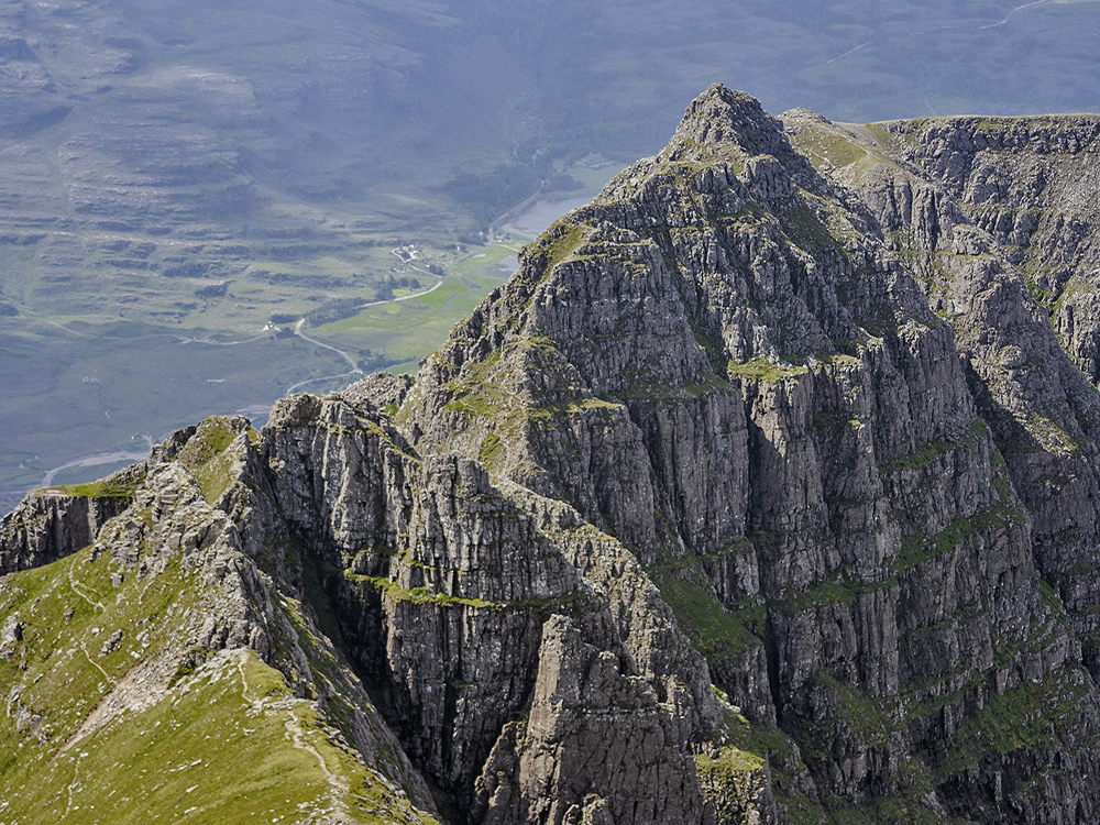
Scotland... It's an amazing and beautiful country, with stunning scenery from sea to summit. With over 2400 miles of wild and unspoiled coastline, rising from sea level to the summits of Scotland's mountains, there is a wealth of dramatic scenery and landscapes explore.
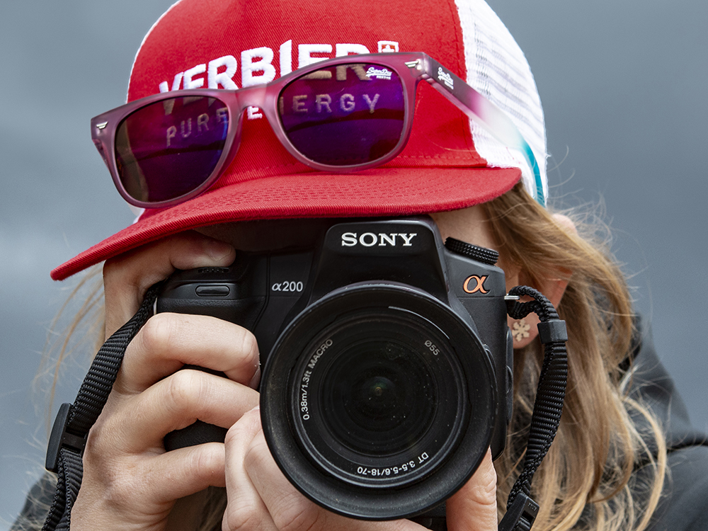
I'm Angus Mackie, an established landscape photographer, CAA Approved drone operator and experienced photography tutor who specialises in panoramic and 360° photography with Virtual Tours as immersive and interactive outputs. Based on the beautiful Black Isle, I'm well placed for the Scottish Highlands, whilst also providing services across Scotland .
I'm also one of the few providers in Scotland who tutors photography as a qualified mountain and sea kayak guide, with many years experience of leading and guiding.
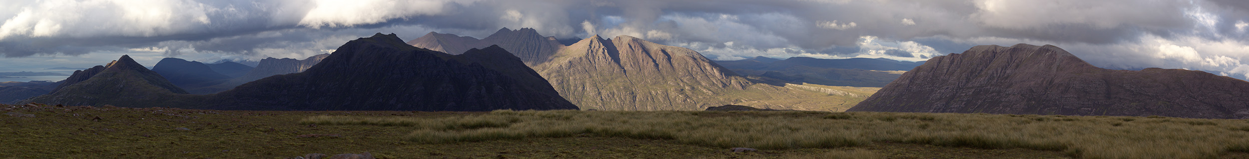
360° Panoramic Photography360° and Wide Angle Panoramas
Landscapes, islands, mountains and historical sites provide perfect settings - from high resolution Digital SLR photography to "one shot" captures of 360° Panoramas.
I specialise in panoramic 360° landscape photography from small detailed studies to soaring aerial panoramas
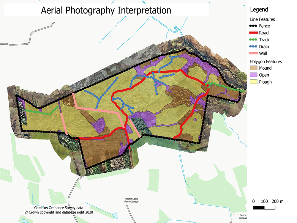
Commercial Drone ServicesAerial photography and survey
I'm a fully qualified and insured Commercial UAS (Drone) Pilot with a current CAA Operational Authorisation for Commercial Drone Operations.
I specialise in aerial surveys and intepretation for forestry from planning through to interpretation and analysis of results, all backed up with many years of experience of using GIS. I also produce 360° aerial panoramas and virtual tours.
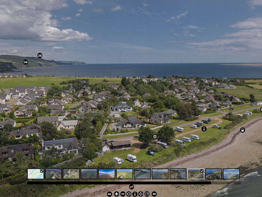
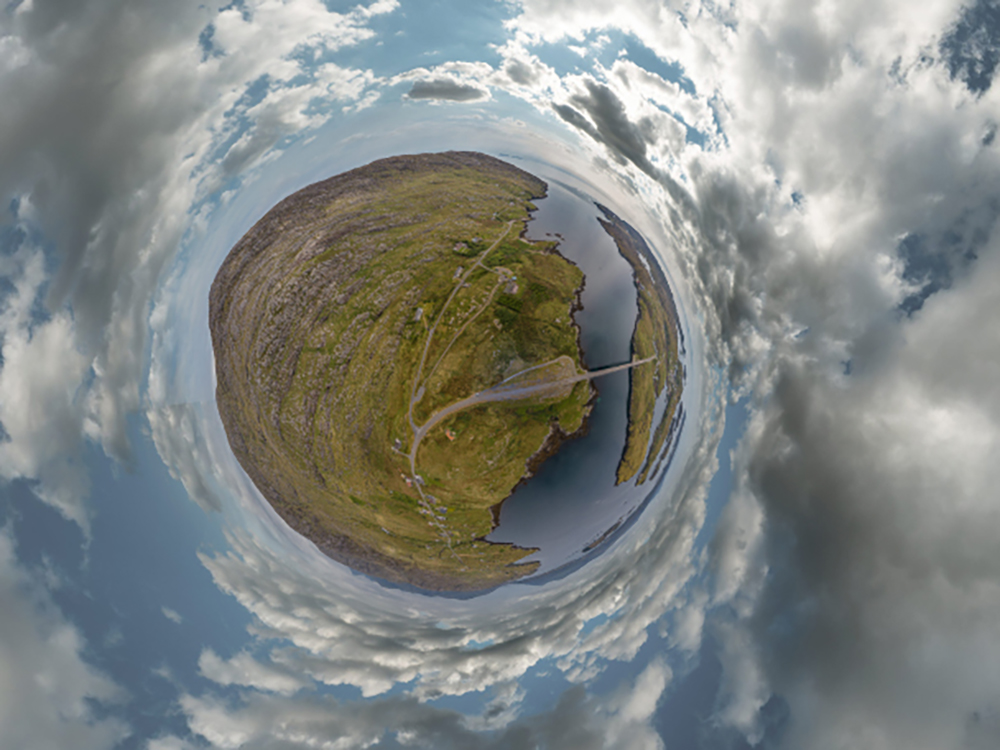
360° Virtual ToursImmersive and Interactive
Virtual Tours and Immersive experiences - from the ground and from the air! Mountains, castles and places of interest transposed into Virtual Reality.
Discover and interpret landscapes from unique perspectives.
Photography WorkshopsBringing landscape to life
I'm an accomplished photographer, experienced in running photography courses so why not join me for one of my Photography Workshops?
Choose from Spectacular Landscapes Workshops, Mountain Phototours or my Bespoke Photography Courses.
Online Sales and DownloadsDigital downloads and prints
The selection of images on my Online Sales Page encompasses the full range of landscapes from "Sea to Summit".
I have an ever increasing selection of online images for sale. Choose from a wide selection of Scottish landscapes across the seasons.
Blogs and JourneysPhotographing adventures
My Blog page reflects many years of photography within the Scottish outdoors, featuring hillwalking, sea kayaking and exploring the outdoors.
Enjoy the journeys and the adventures...
My Services - all backed up by many years of experience
Professional Photography
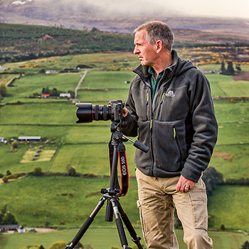
I’m Angus Mackie, a professional photographer based north of Inverness on the Black Isle and within easy reach of the Highlands. Iconic Glen Affric, the Cairngorms and many of the wild and dramatic locations on the west coast are within easy reach.
I specialise in landscape and panoramic photography, including mountains, landscapes and coastlines in wild and remote locations. With a broad and wide ranging knowledge of the Highlands, I still enjoy finding new locations and fresh perspectives for my photography. The use of natural light to capture stunning scenery at spectacular locations is very much a key factor for my photography.
I accept wide ranging commissions ranging from landscape to real estate to publicity and events.
Find out more about my Photography ServicesDrone Surveys for Land & Forestry
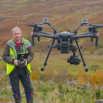
With a background of managing surveys and Geographic Information Systems, I have also developed my own aerial survey and mapping protocols for land and forestry projects. From survey and interpretation to mapping and topographic modelling, all backed up with over 40 years of experience in forestry.
Utilise the capabilities of drones to:
- Reduce your survey costs
- Capture information quickly and accurately
- Maintain a digital workflow from acquisition to report
- Add value to surveys and reports
Panoramic Photography & Virtual Tours
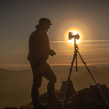
Landscapes, islands, mountains and historical sites provide perfect settings - from high resolution to "one shot" captures of 360° Panoramas.
I specialise in capturing panoramic 360° landscape photography with scales ranging from small detailed studies to soaring aerial panoramas. My Black Isle aerial virtual tour was featured by LNER and Forbes during the Covid lockdown in 2020.
Visit my Virtual Tour PagePhotography Workshops
I offer a range of photography workshops, specialising in landscape photography tuition on a one to one basis and for small groups.
I’m an experienced guide who can translate your initial ideas, building up a bespoke itinerary set in iconic locations. I’ve planned sunset photography expeditions to mountain summits and led sea kayaking photography workshops in the beautiful coastal waters of Skye and the west coast. I have run multiday courses both for my own clients as well as in partnership with others and I will enjoy building a unique, enjoyable and memorable photography experience for you.
As a qualified and experienced mountain and sea kayak leader, I can uniquely extend the range of possibilities, tailored to your experience and aspirations. Set in unforgettable surroundings, I offer possibilities that few other photography workshops can provide.
Find out more...GIS services
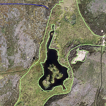
I provide a range of GIS and Digital Mapping services, specialising in rural land management mapping, analysis and interpretation.
Contact me for more information.
Email AngusCommissioned by and Featuring in....