


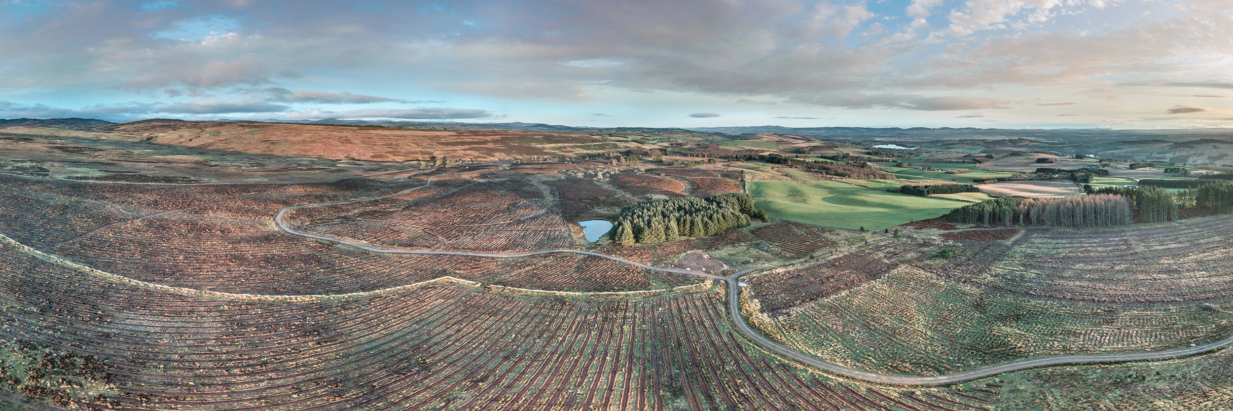
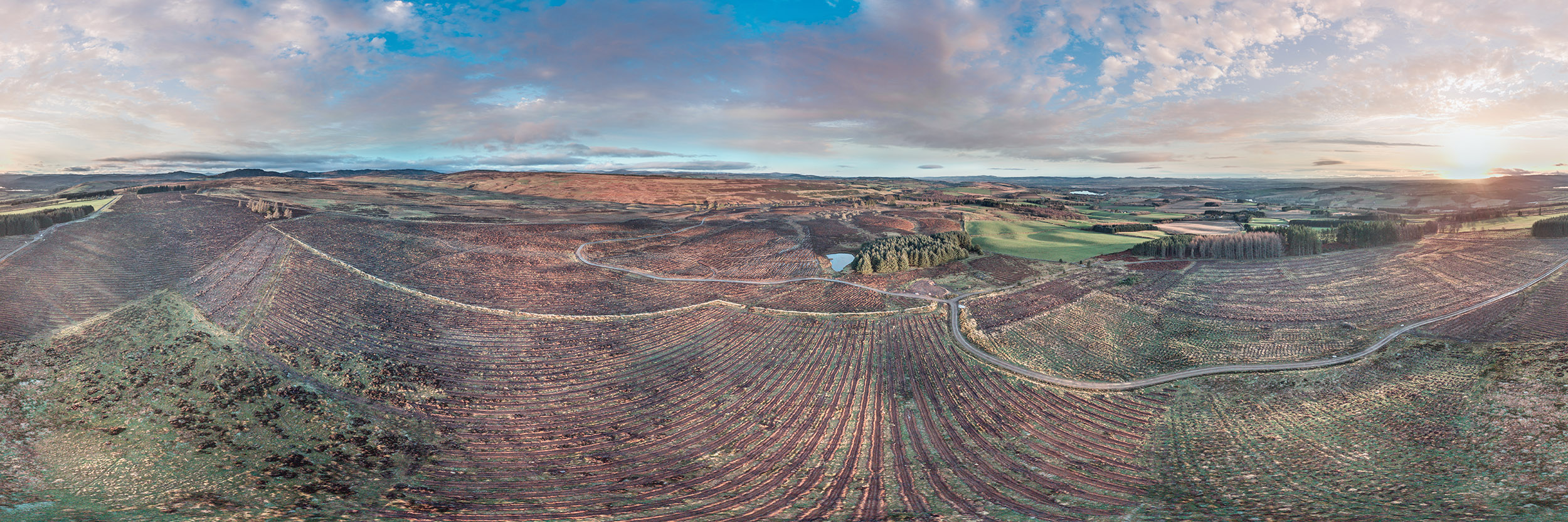
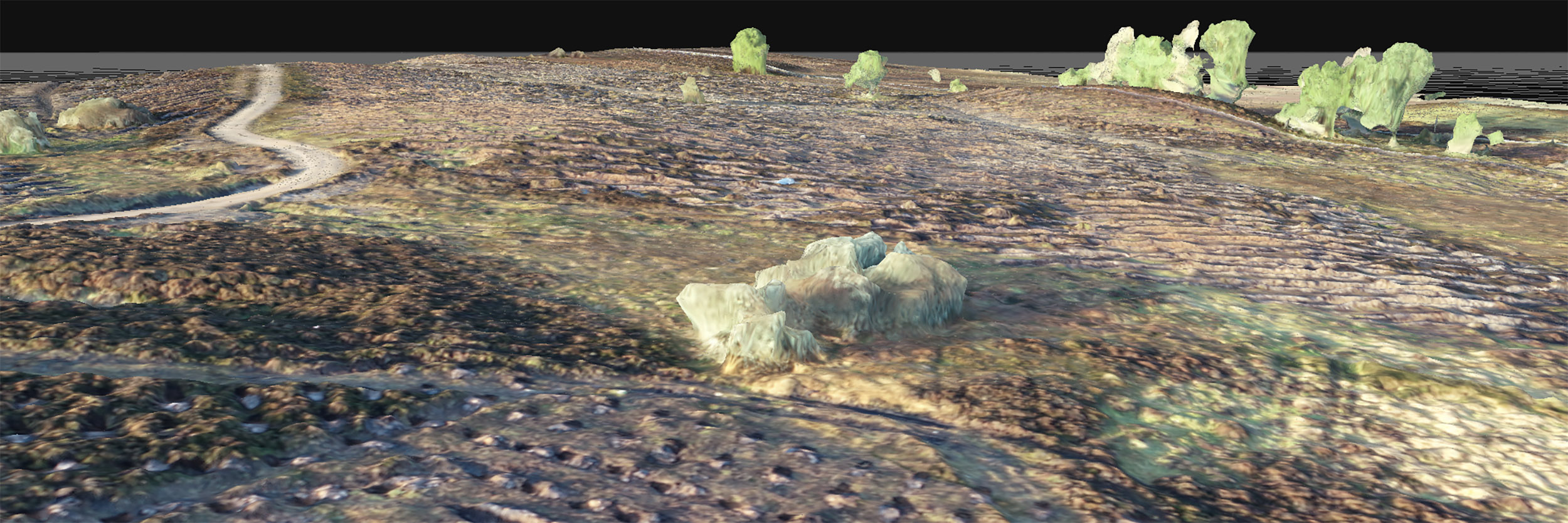
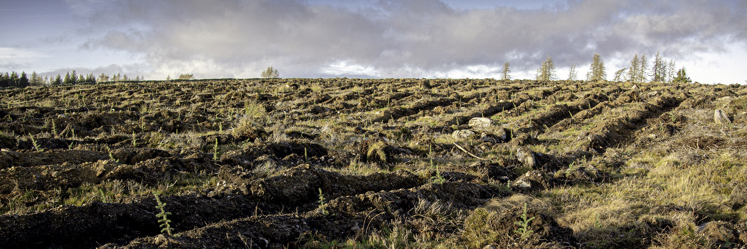
The 360° aerial, panoramic view across Seefar Hill on Forneth Estate
Drone Based Aerial Survey and Mapping Solutions - Seefar Hill
A case study by Angus Mackie, FICFor
07780 787034
Background
This case study follows a drone based aerial survey I delivered for Savills Forestry in December 2020. The survey was commissioned to provide aerial survey data, interpretation and mapping of a 100ha woodland creation site at Seefar Hill, Forneth Estate in Perthshire.
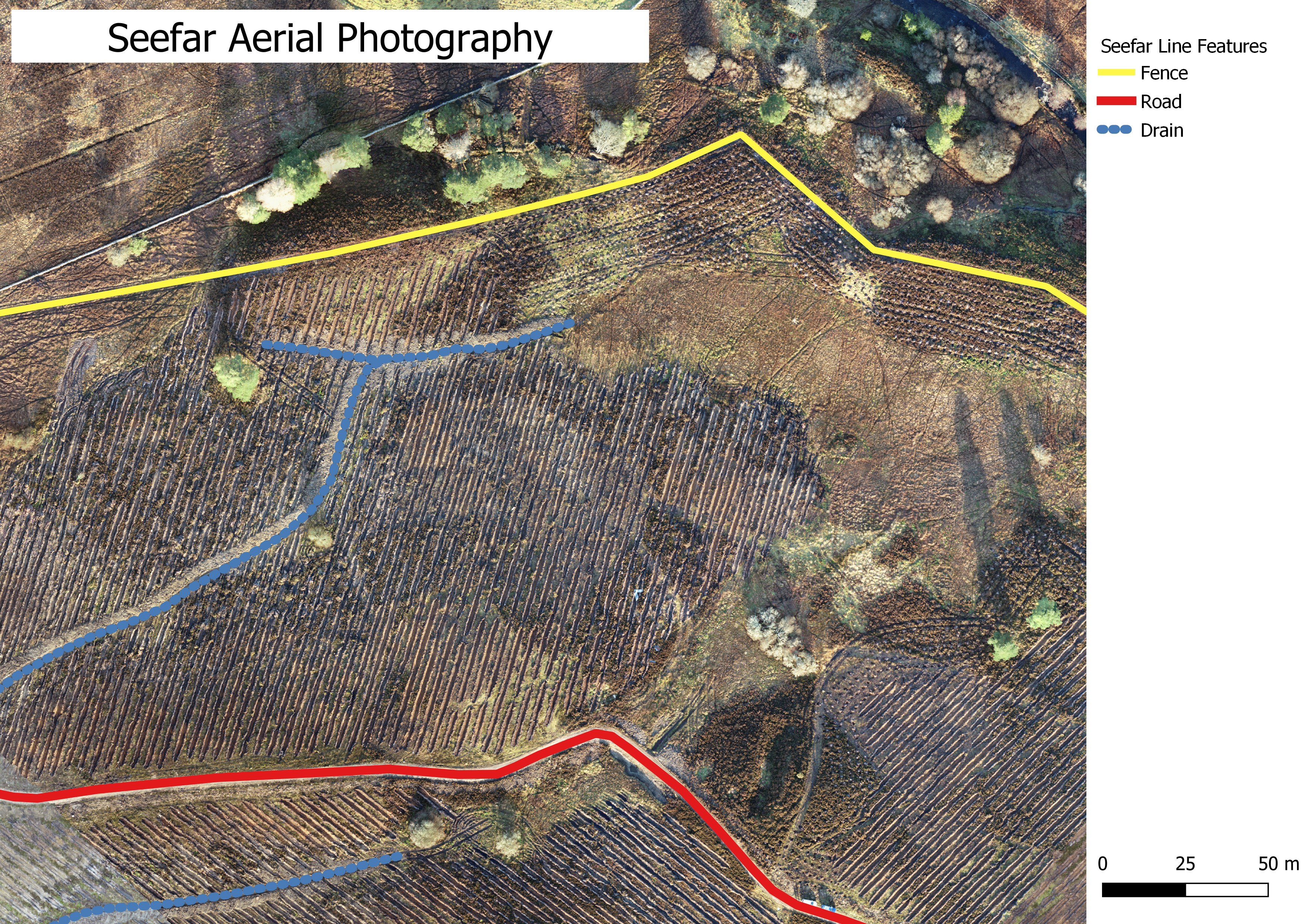
The primary requirements included a survey of all completed ground preparation operations with secondary objectives to survey and map the new fence line, the upgraded road and other features of interest.
In planning the survey, I programmed the drone flight lines using autonomous flight planning software. This utilises GPS information, not only to configure flight plans but also to record the location data embedded within the photography. This is integral to survey accuracy and integrity. Delivery of the final output comprised Geographic Information System (GIS) shapefiles based on interpretation of the aerial survey data.
The survey was commissioned in late November 2020 and I delivered the final results in early January 2021. Due to short days and poor light during December, the survey required several days on site However longer days and better light would allow for much faster data capture by maximising time on site.
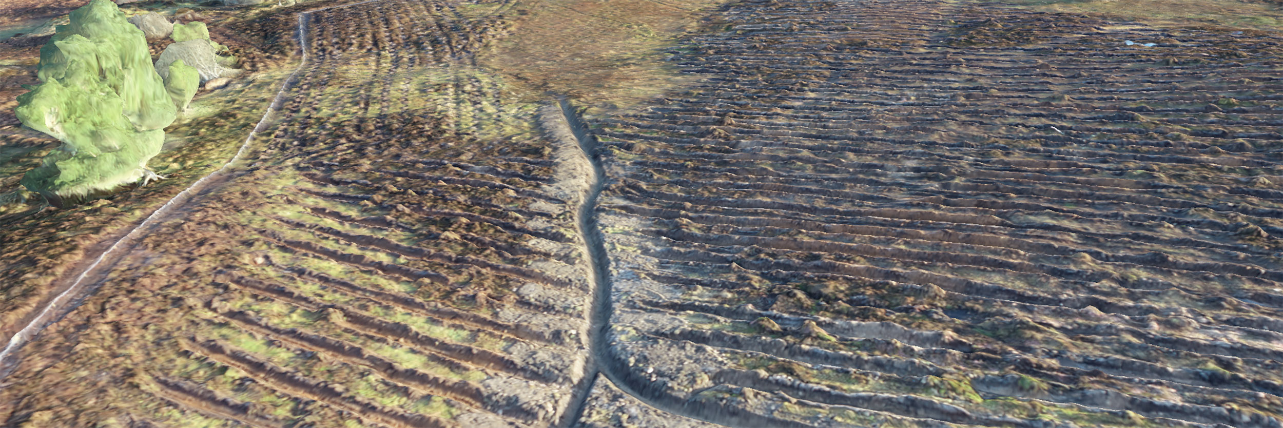
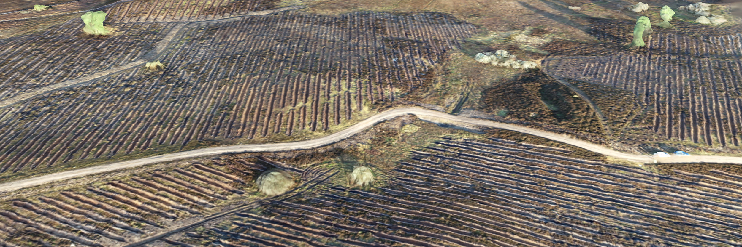
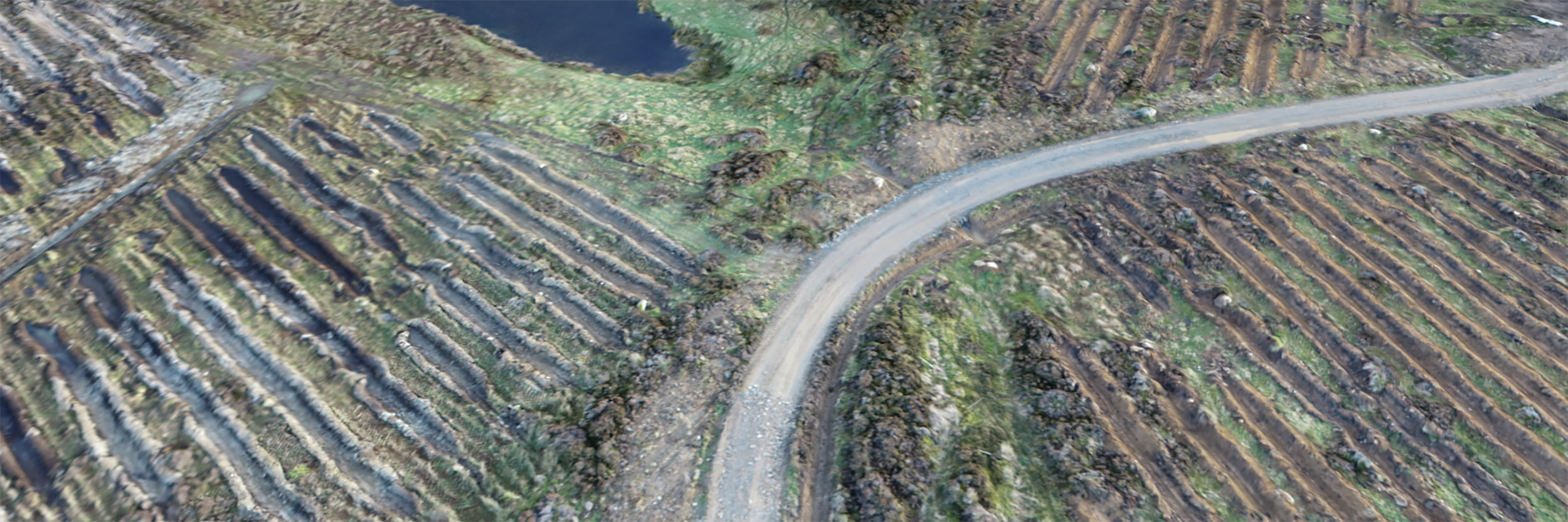
For demonstration purposes to Savills, I also captured video footage, compiled a 360° panorama with an embedded virtual tour of the site and processed a number of 3D models, based on point cloud technology. These outputs demonstrate additional, interactive presentation options, harnessing the benefits of drones
The background to the methodologies is provided in the sections below and provides further detail on survey methodology.
Angus Mackie FICFor
February 2021
angus@scotland360.co.ukIntroduction
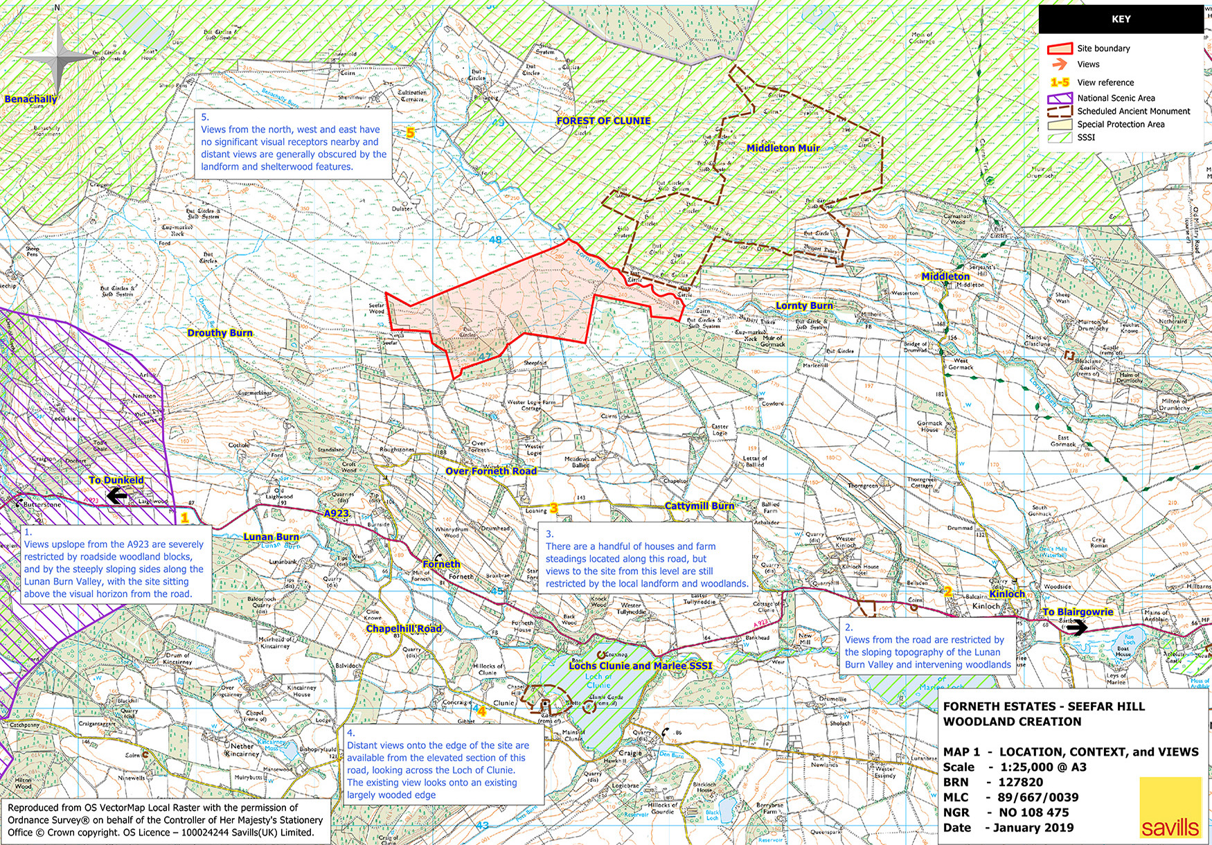
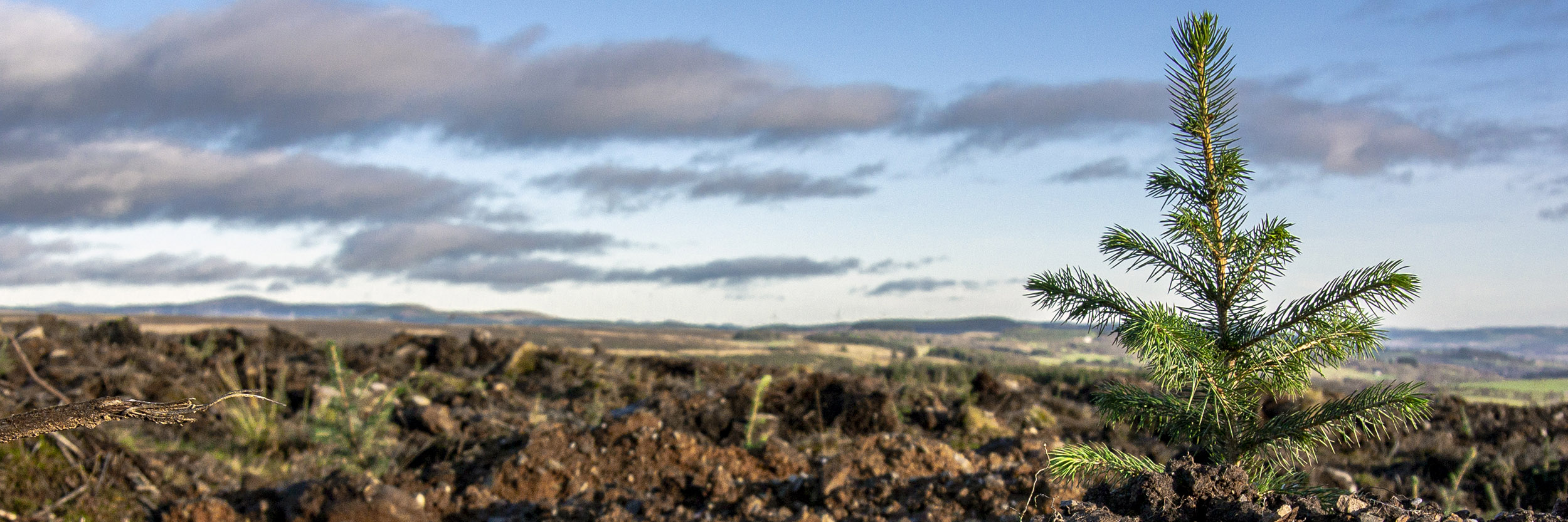
Seefar Hill between Dunkeld and Pitlochry is a new commercial woodland creation project of around 100ha, managed by Savills Forestry.
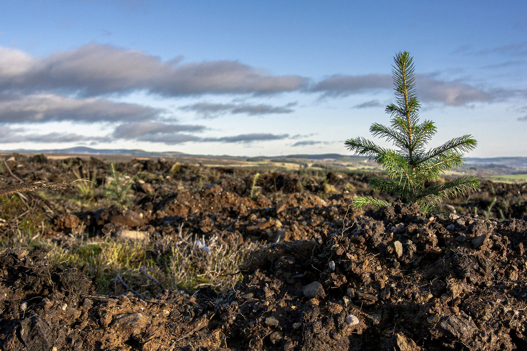
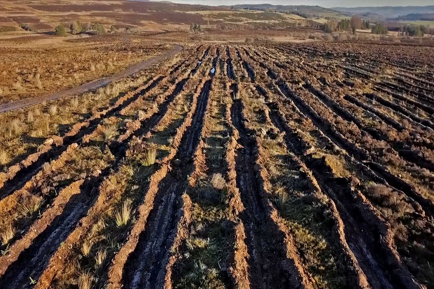
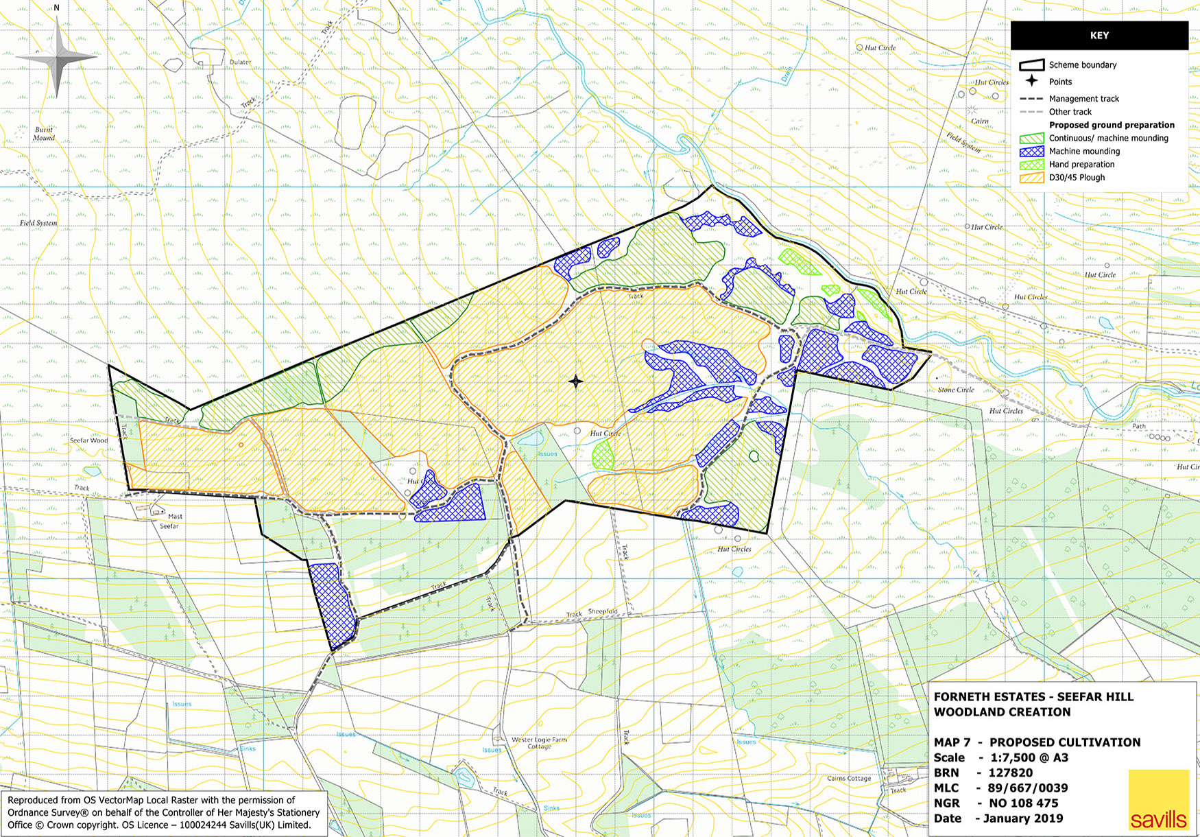
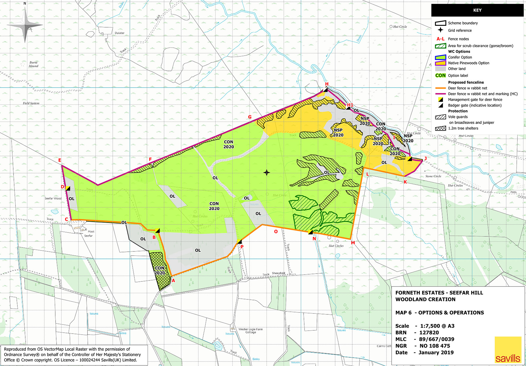
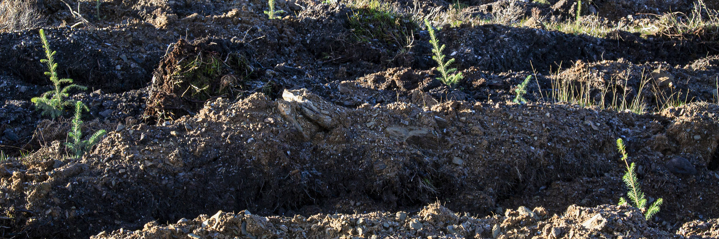
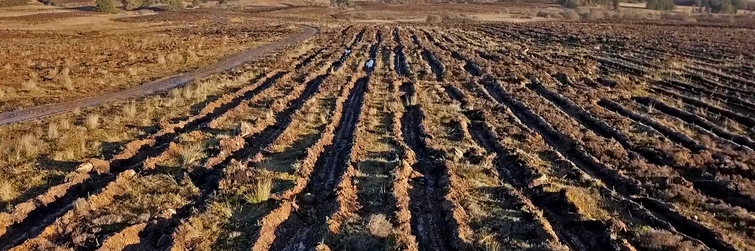
Initial establishment operations comprised deer fencing, ground preparation and associated drainage as well as improvements to the existing road. The majority of the site was ploughed using a D30/45 plough with machine mounding in areas unsuitable for ploughing.
Fencing and ground preparation were completed in late November 2020, prior to commencing planting of the site.
On conclusion of the establishment operations, Savills required accurate survey and mapping of the site to allow the submission of the grant claim to Scottish Forestry.
The brief for the work included the drone based aerial photography survey of the site with subsequent mapping and interpretation of:
- Ground preparation types
- Drainage
- Roading
- Fencing
- Other features of interest
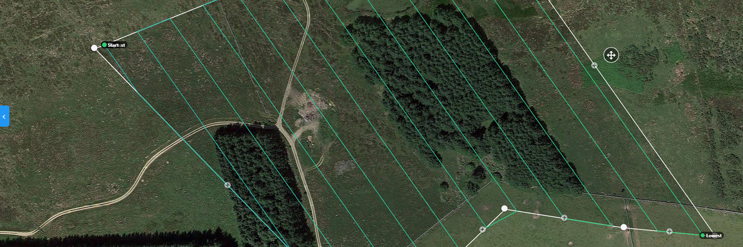
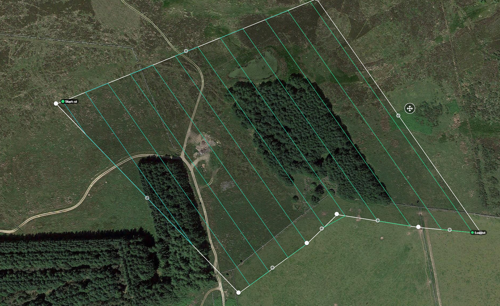
To ensure that all drone flights complied with CAA regulations, I used GIS to stratify the area and to compile the flight plans for the area. The information provided the survey parameters which comprised area captured, flight times and the survey intensity.
Flight plans were uploaded into the autonomous flight software ready for survey of the area.
With short daylight hours during late December and poor weather during the period of the survey, my flight timings were limited and it took several days to complete the survey. A comparable area could realistically be flown within one day in summer with better light and longer days.
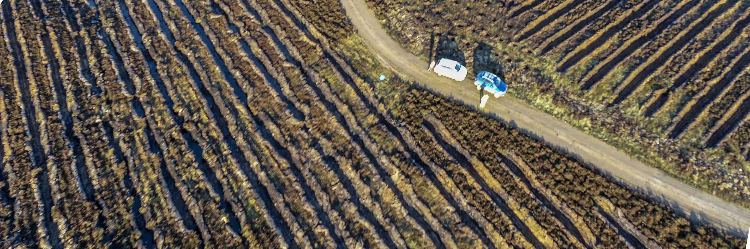
I used a DJI Phantom drone with a 20MP camera to capture all still images. My backup drone, with a12MP camera, captured video footage at 4K resolution. A portable power pack allowed me to recharge drone batteries on site, during the day, extending flight capability and endurance.
Results
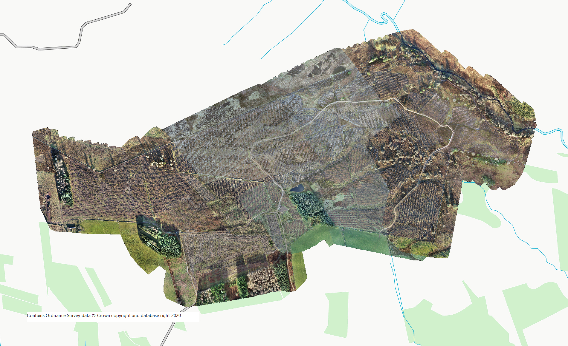
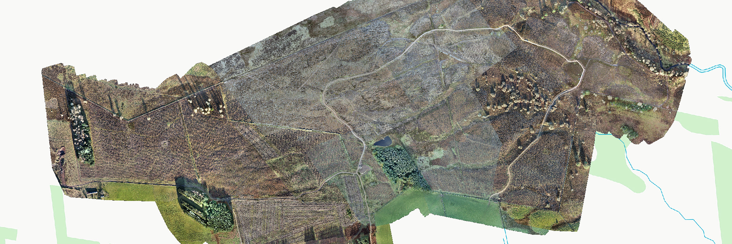
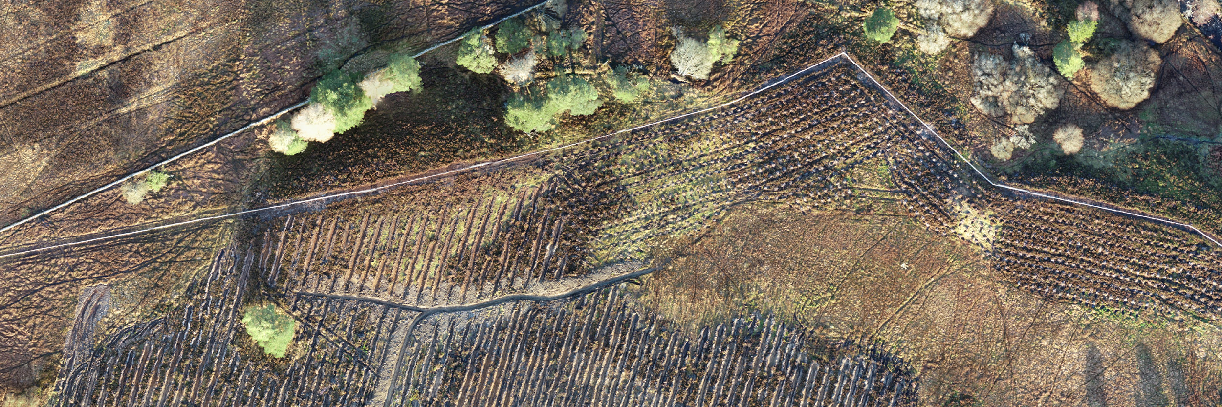
I processed and mosaiced all photography from the flight plans into a final, composite orthorectified aerial image for the site.
I then calibrated the GPS points captured by the drone against Ground Control Points as part of the final quality control process to ensure optimum accuracy.
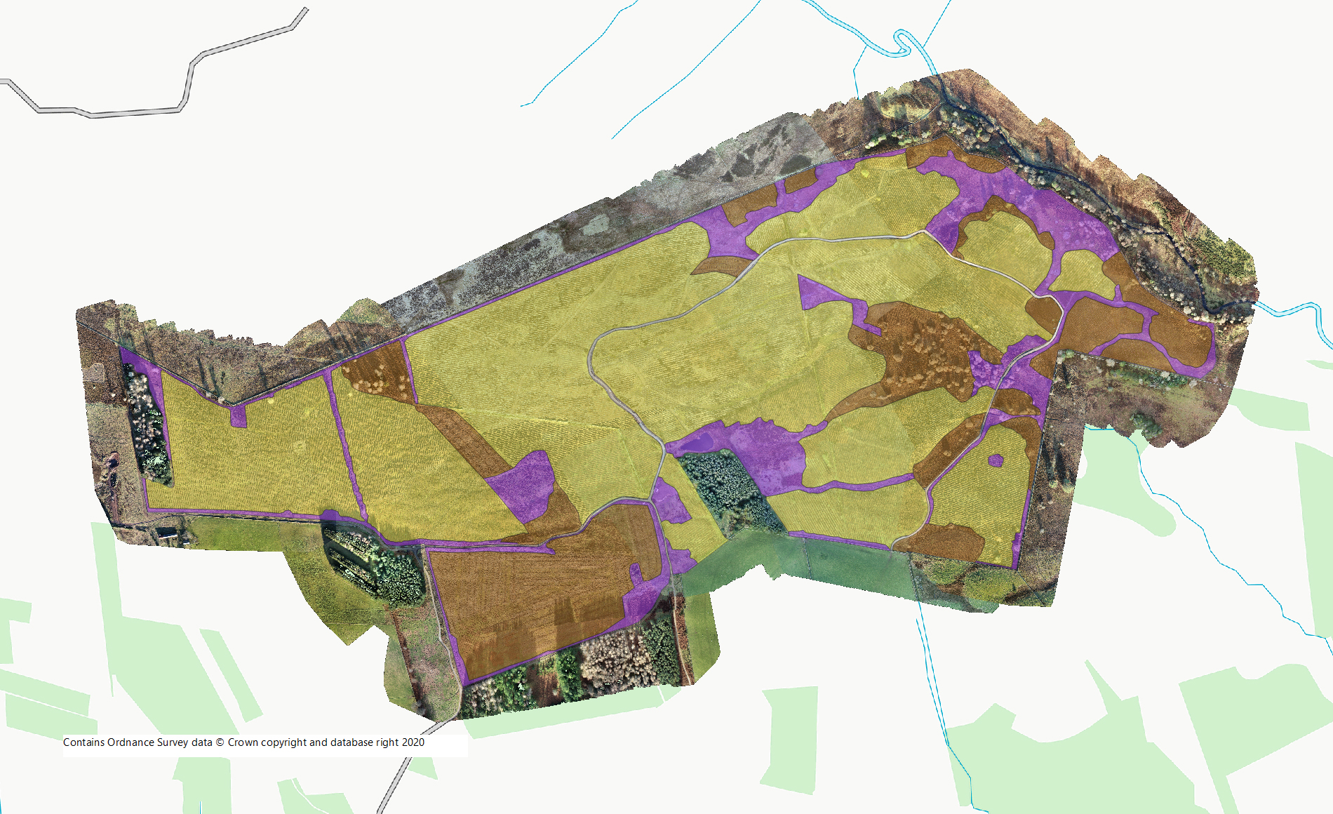
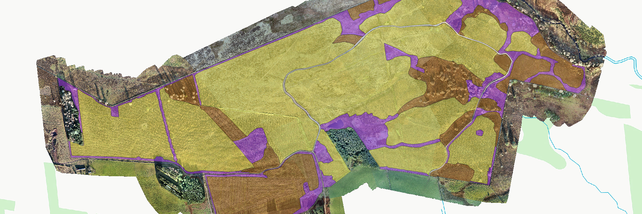
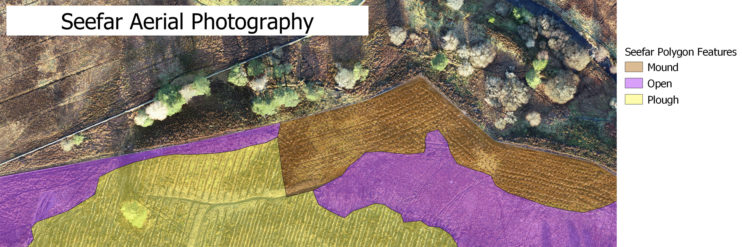
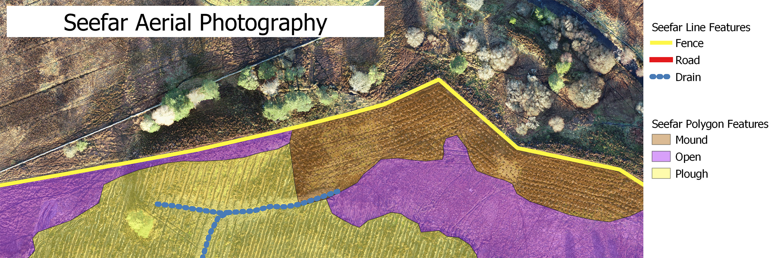
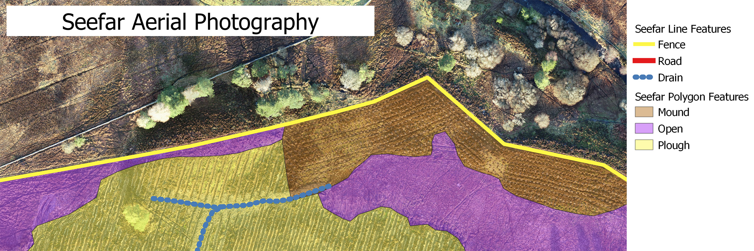
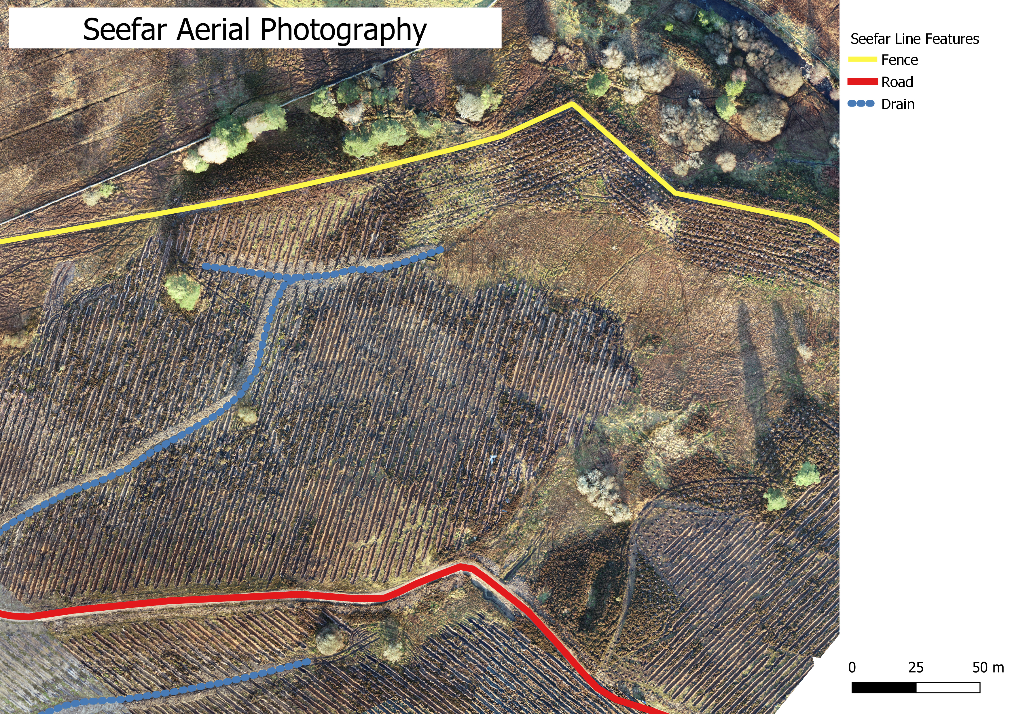
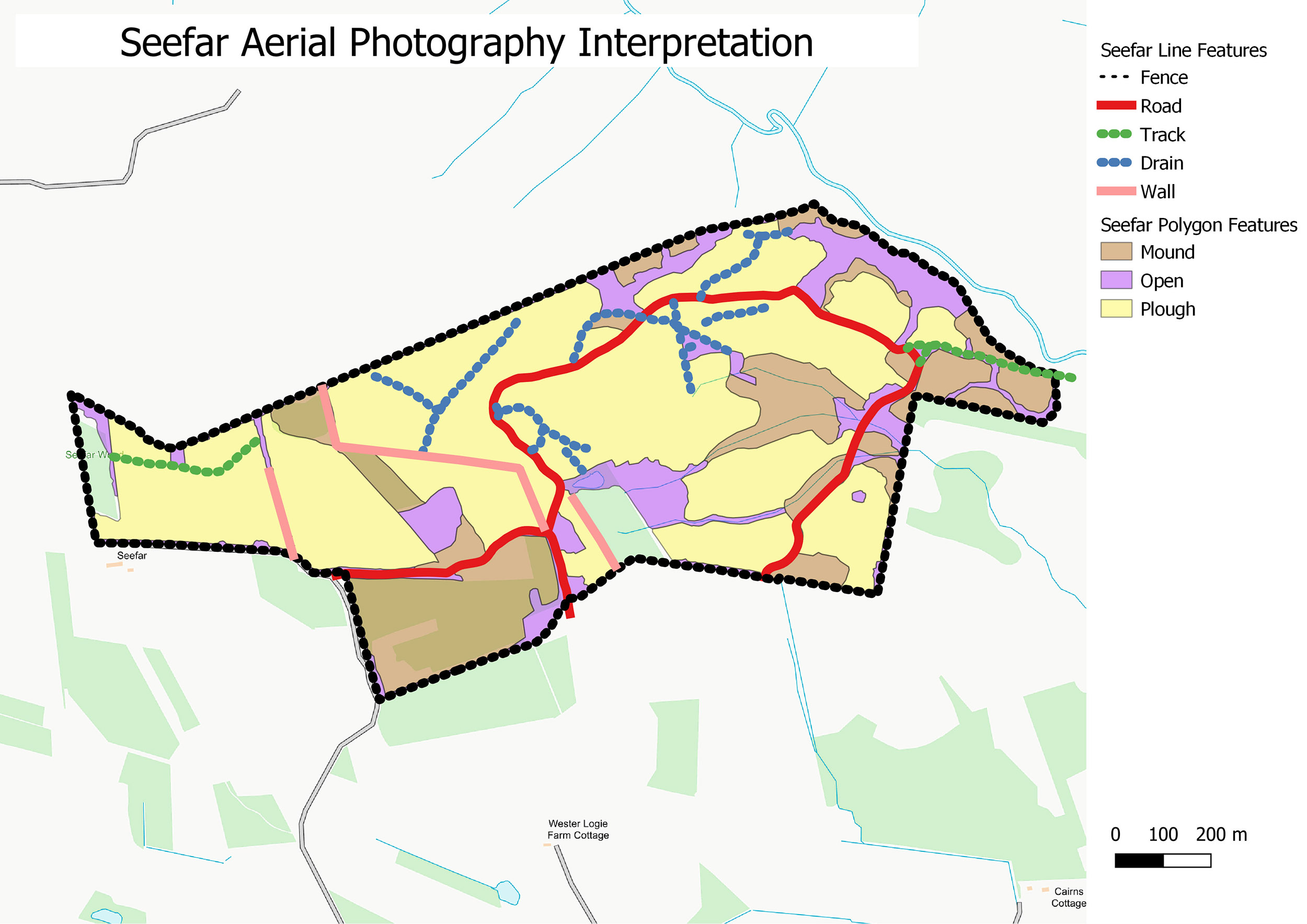
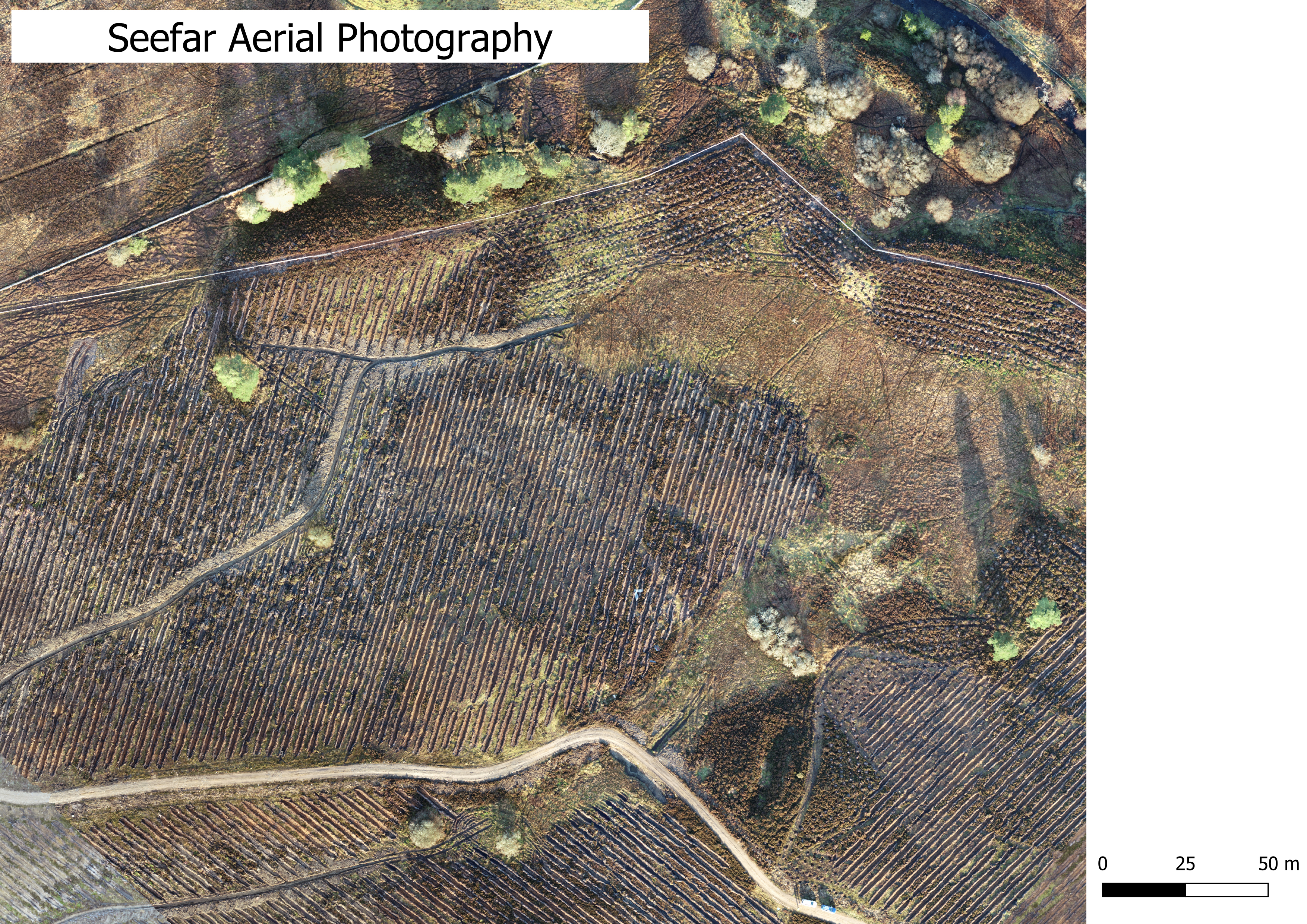
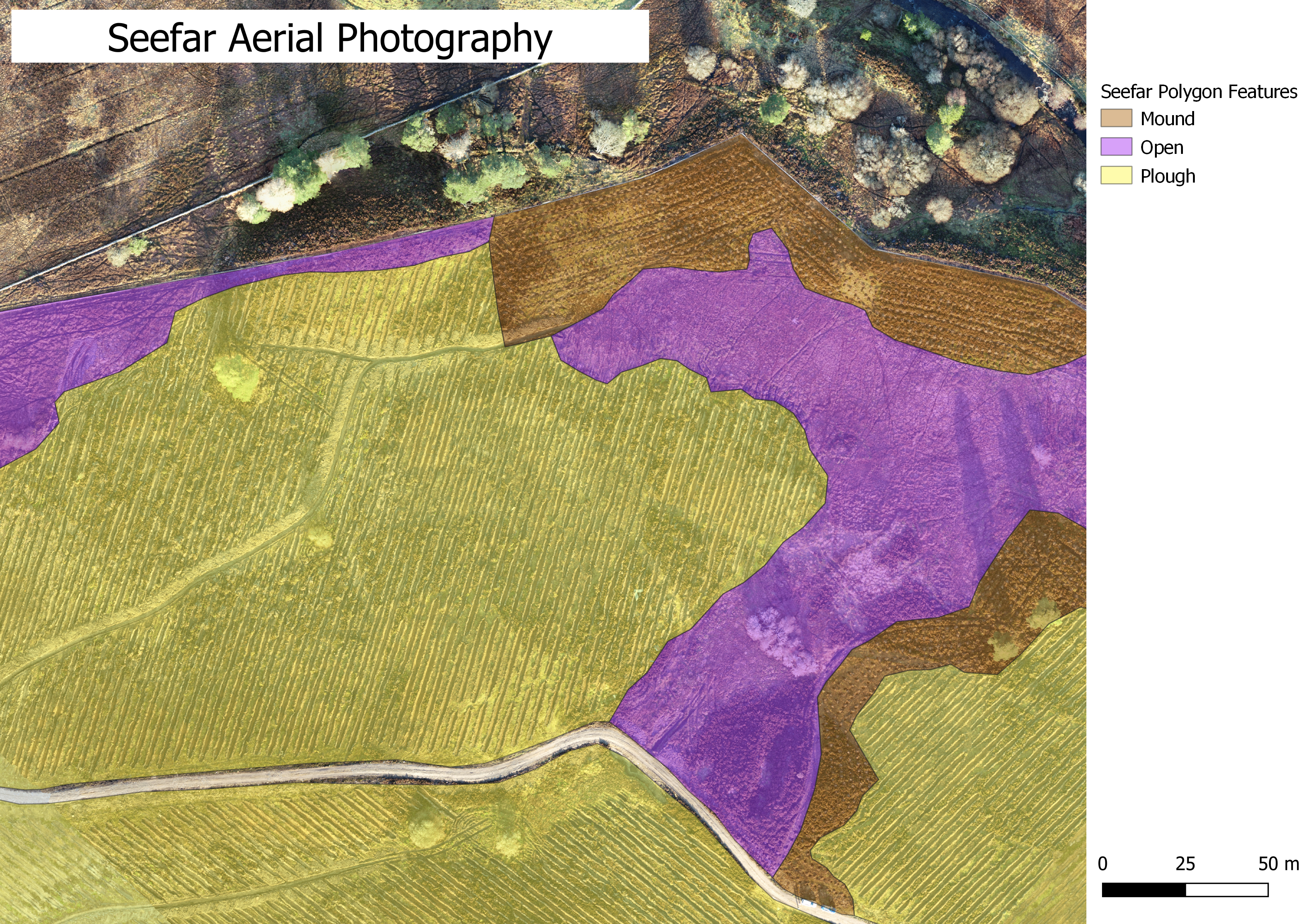
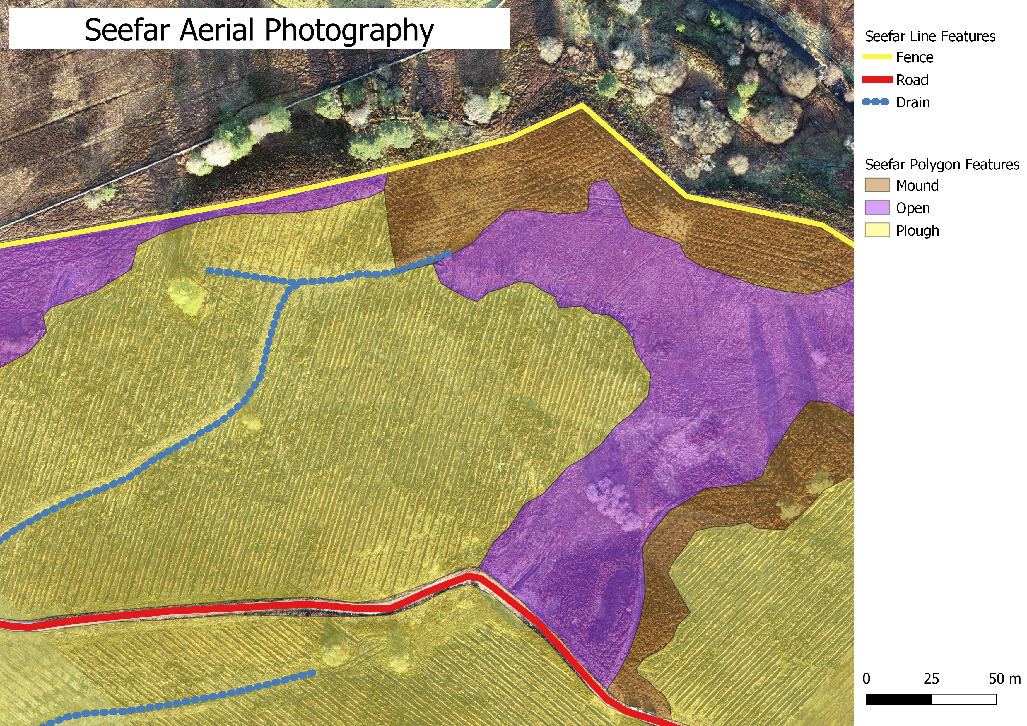
Having processed the aerial images, I interpreted the ground preparation features and open ground from the aerial photography, mapping these as GIS layers.
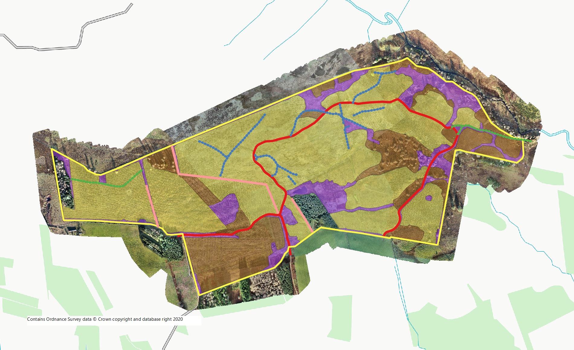
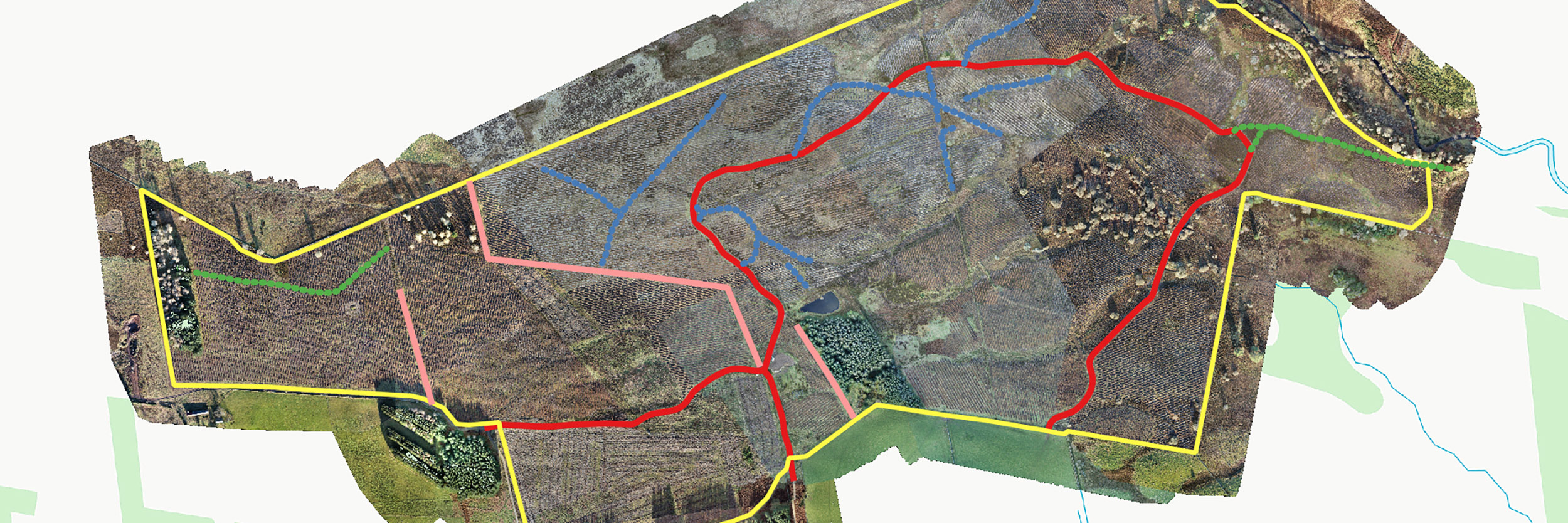
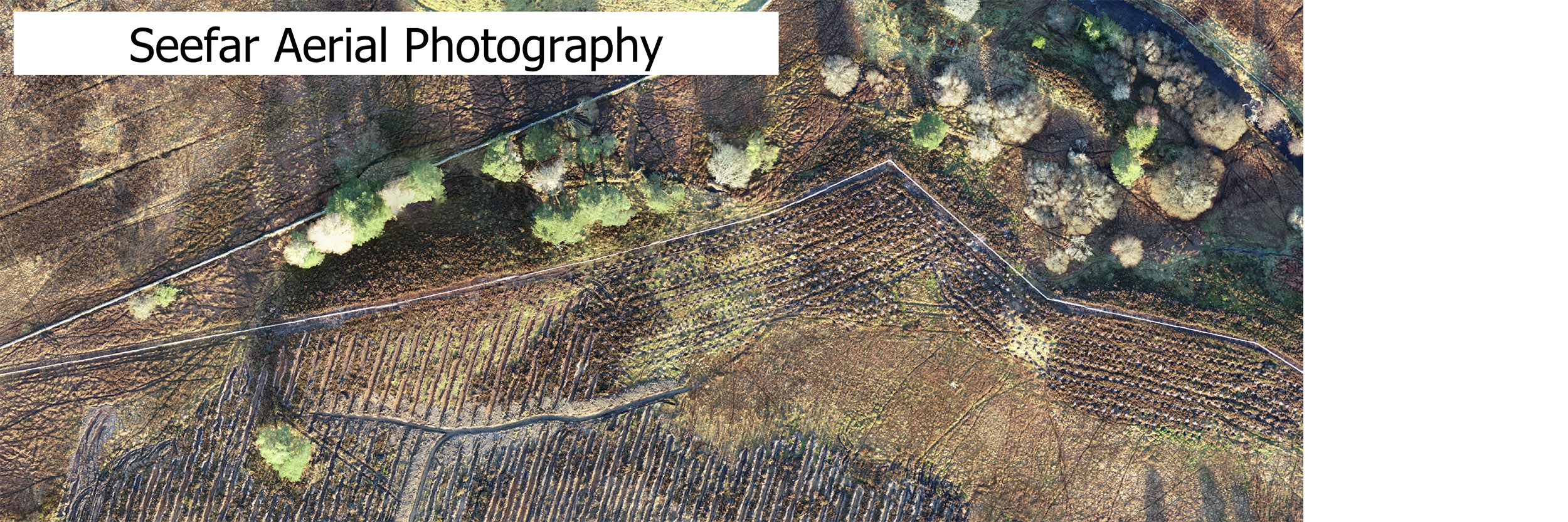
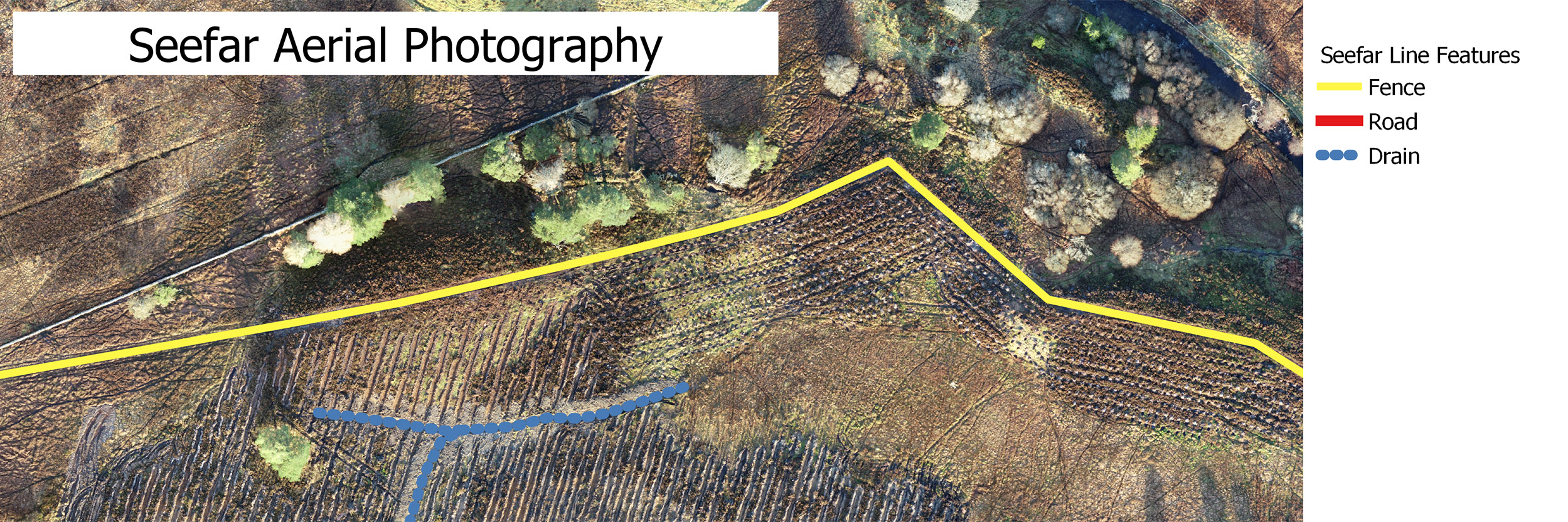
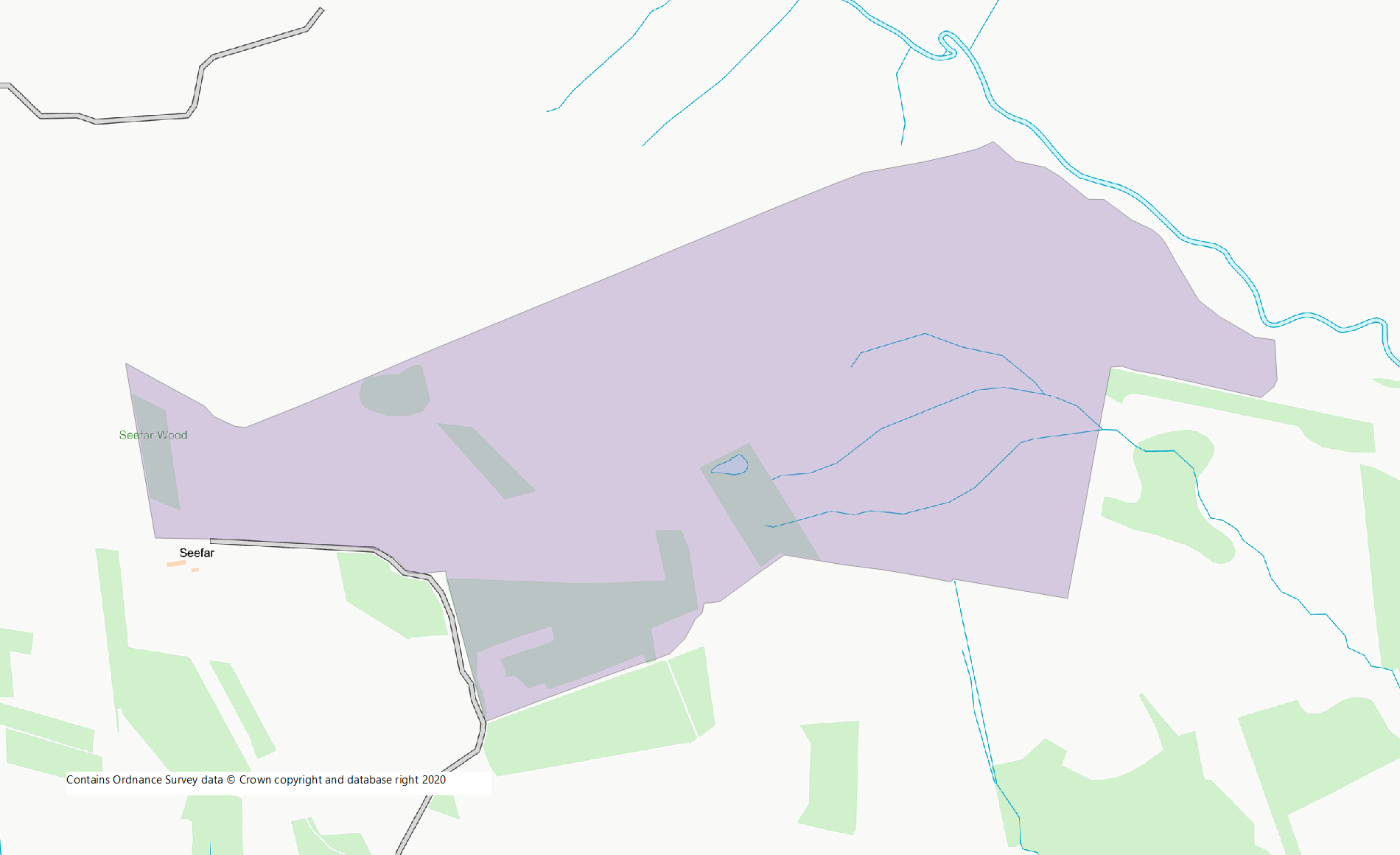
I also mapped roads, drains, fences and other features of interest from the aerial photography. The GIS outputs below show the detailed interpretation from the northern section of the site, whilst the map of the full site shows the features overlaid on the aerial photography
The final submission to Savills incorporated:
- Composite photography for each flight plan.
- A final composite image covering the full extents of the woodland creation site.
- A GIS shapefile for ground preparation areas, including open ground.
- A GIS shapefile of linear features including roads, drains and fences.
Seefar Hill - The Virtual Tour
As a final comment - and unrelated to the contract. Whilst on site, I took the opportunity to capture a 360° aerial panoramam of the site. I've procesed it and added it to the case study as an example of how to compile the various images and videos into a Virtual Tour.
The accompanying panoramic image has a series of hotspots which will open up some of the images from this page. The hotspots correspond to the location of the images to add context and to geo-locate the images. The locations of the aerial videos are also provided by the hotspots. Use the fullscreen buttom to maximise the erial panorama and you'll see the extent of the project.
For more information or to discuss potential projects, please call: 07780 787034 or email:
angus@scotland360.co.ukAngus Mackie
Birchmill House, Culbokie, Dingwall, IV7 8JH